PARQUE NACIONAL RÍO CLARILLO (CH-MEA)
Description
The Río Clarillo National Park is located within a basin delimited by high peaks and their watershed, with altitudinal differences between 930 and 3900 m asl. Morphologically, it is a complex system of superimposed cones, the oldest of which are of lacio-volcanic origin, then effluvium-volcanic and the most recent of hydriocinerite origin. Towards the interior of the National Reserve the slopes are more abrupt, with predominance of high peaks. The soils in the Reserve are characterized by being thin and underdeveloped, with maximum depths of no more than 75 cm. Its interior is formed by volcanic rocks, mainly andesitic and rhyolithic with intercalations of sedimentary rocks. They are loose textured soils, predominantly sandy and light-colored. In creek environments the substrate is no longer formed only by primitive mineral matter, but by organic substances originated from the decomposition of plants and other organisms.
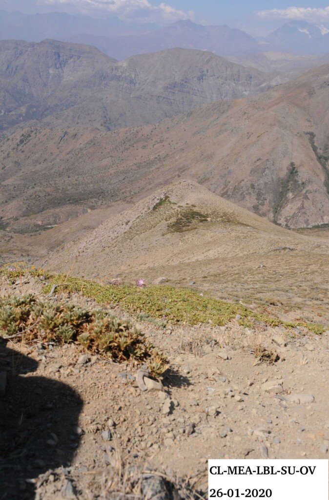
The three peaks of the site are located within the Chilean Mediterranean Andean Scrubland ecoregion, which is characterized by a temperate mediterranean climate with rainy winters and a dry season that extends between December and March. The Andean Scrubland corresponds to formations dominated by low shrubs (<0.5m) with variable coverage. Within the Reserve you can also find intra-zonal vegetation of Riparian laurel sclerophyllous forest. In the context of global warming, a strong decrease in winter rainfall has been observed in the last decade, having a significant effect on the intra-zonal vegetation mainly.
The area of the Reserve is 13.085 hectares, and human intervention is restricted to extensive low-intensity grazing of cattle and horses, mostly concentrated between 900 and 2000 m asl. In the lower section of the Reserve (between 900 and 1500 m asl) there are spaces for recreational activities in nature, with clear indications for use and care of the environment. These activities are restricted to limited areas between 900 and 1500 m asl and are guarded by the Reserve’s park rangers.
The prospecting of the site began in May 2018 and ended in April 2019. The installation was carried out in three campaigns between December 2019 and February 2020, with the first campaign lasting seven days and the last two campaigns lasting 10 days each.
Location
The site is located in the Reserva Nacional Río Clarillo, in the Metropolitan Region of Santiago, Cordillera Province, Pirque Commune, about 45 km from Santiago, the capital of Chile. The surface of the Reserve is 13.085 Ha and geographically it is compromised between the parallels 33. 6833° 33.85° LS and the meridians 70.4° and 70.4833° LW, being the summits located in the mountainous ranges of the Reserve by the Cajón de Los Lunes (33.8183 LS and 70.4693 LO).
Summits
Cipreses 2100 (CIP, 2145 m asl), Loma Blanca 2300 (LBL, 2330 m asl), Manco Ballo 2700 (MBA, 2770 m asl)
Responsible Institution:
Ministerio del Medio Ambiente, División de Recursos Naturales
Site coordinator: Petra Wallem (pwallem@mma.gob.cl)
Database responsible: Petra Wallem
Botanist/Taxonomist: Nicolás Lavandero, Nicolás García
Related resources:
Álbum con fotografías de flora vistas durante las campañas del Sitio GLORIA MEA
Álbum con fotografías de las campañas de instalación del Sitio GLORIA MEA

Rio Clarillo Chile
To date we are in the process of taxonomic verification of species identification in the field. However, to date we can indicate that we have the registration of 39 families, with 71 genera approximately.
The three peaks of the site cover two vegetative formations:
Andean sclerophyllous scrub formation: This plant formation penetrates deep into the Andean mountain range through the river cavities, establishing a complex mosaic of local associations and great diversity. It is formed mainly by colliguay (Colliguaja integérrima), espinillo (Adesmia arborea), frangel (Kageneckia angustifolia), guindillia (Guindillia trivervis), pingo-pingo (Ephedra andina), accompanied by wild flowers of the genus Alstroemeria, Calandrinia, Cacleolaria, Chloraea, Clarkia and Mutisia.
High Andean steppe formation of Santiago: It represents the upper altitudinal floor of the vegetation in the central zone of the Andes. Due to the nature of the mountainous relief of very abrupt character, its distribution is discontinuous, taking in certain places the desert aspect of altitude. In the vegetal species they predominate the xerophyte aspect, bushes and grasses, pulvinadas and cespitosas. From 1800 m asl stunted species are observed as quinchamalí (Quinchamalium gracile), white grass (Chuquiraga oppositifolia), and llaretilla (Azorella ruizii). These communities are represented in 1300 ha of the Reserva Nacional Río Clarillo.
No data temperature